Day Twenty-Nine of ORCA in Switzerland – A Desire To Go On A Hike
|

Day Twenty-Nine of ORCA in Switzerland – A Desire To Go On A Hike

We’re in day 29 of ORCA in Switzerland and I have an ever increasing desire to go for a hike. During today’s walk I listened to two podcasts about hiking and I walked yet another variant of my usual walk. Apple tree blooms are increasing in number and the Colza looks almost ready to harvest.


We’re also going into a dry summer. During this pandemic we have hardly had any rain for a month. The whole of Switzerland is either yellow, orange or red with the risk of fire. I’ve been walking outdoors with a t-shirt.


We could be under the illusion that Switzerland has beaten the virus but that’s an illusion, because the risk of a new center of contagion is possible. We have to continue self-isolating. Today two children cycled too close to me so I crossed to the opposite side of the road because they stopped and would pass me again.


View this post on Instagram

@ladylockoff had some fun photo shopping this picture of @marcusblatherskite and I. It reminds me of a similar picture that our friend Matt photo shopped. When I posted Matt’s ball pit bouldering photo my poor mother thought it was real and asked me how long it took to clean up all those balls. ????? Good times. 1rst photo by @ladylockoff 2nd photo by @matt_likes_climbing #climbingphotography #climbing_photos_of_instagram #climbinginspiration #climbing #climbinglovers #climbinggirls #climbing_is_my_life #climbing_worldwide #climbingrocks #climbingnation #climbinglife #outdoorclimbing #crackclimbing #tradclimbing #climbingpicturesofinstagram #iloveclimbing #climbing_pictures_of_instagram #climbingpics #rockclimbing #rockclimbinglife #climbon #liveclimbrepeat #climbingisbliss #climbingnation #climbingday #doyouclimb #rockclimber #climberlife

A post shared by Mary Catherine Eden (@tradprincess) on

Day Twenty-seven of ORCA in Switzerland – River Walking
| | |

Day Twenty-seven of ORCA in Switzerland – River Walking

My shoes are wet and my socks are wet because today I tried river walking. If a child was to do the same it would be called immature and irrational but when an adult does it then it’s adventure, and trying something new.


My motivation to river walk came from the pandemic, or more precisely from how people behave during a pandemic. When I walked yesterday I had a runner pass right by me and then spit on the ground a few meters ahead of where I would have been going. When I walked through the woods yesterday I could hear groups of people so I avoided walking along the same routes.


That’s why I placed both feet, and the shoes they were in, into the river and walked. I didn’t get that far. In fact I was only able to walk a few dozen meters before finding that the river would have required wading. I wasn’t prepared to do that. We’re not in a heatwave yet.


Channels are dug into the rocks


Although you can’t really see it in the image above grooves have been worn into the rock strata. As a result you shouldn’t spend all of your time looking forward because you’ll be caught out. River walking requires you to look at where you’re placing your feet. In the image below you can see these erosion patterns more clearly.


Grooves in the rock
Grooves in the rock


I’ve walked along the routes so much that now I’m starting to get to know the details. Now I know that the river is beautiful and that if you’re willing to get wet you can see some nice features. There are a few places I need to return to, and document through photography.


This morning I was looking through to see if Thru-hiking had started and to see whether people would still try to thru hike any of the main trails in the US and from what I see most people have not started and those that did have postponed their hikes for now.


As a follow up to this I listened to this episode of the Hiking Thru podcast. It’s about Chris Smead going for a lesser known Thru hike with eleven lenses, seventy five batteries and a monopod to document a hike with a group of people. The hike sounds like an interesting experience. It also makes a nice change from listening to so many news and current affairs programs. A moment to dream.


https://www.youtube.com/watch?time_continue=161&v=dbkE6UbIiAU


I will keep exploring. To a large degree I treated today as if there was no pandemic and that was refreshing. I still washed my hands as soon as I got home. I just didn’t stay cooped up indoors without treating myself. Exploration is a treat.

Looking Back In Time
|

Looking Back In Time

For a few days now I’ve been looking through thousands of pictures to make sure that they’re synced from iCloud to the Photo app before they’re deleted. In so doing I noticed how far in front of a group I was hiking a few years ago. Instead of hiking with the group I was so far in front that I could get group shots without trying. Eventually, they did pose, as if it had been intentional rather than my walking habit.


What you see in the pictures is that I did stop and I was with the group a lot, waiting for people to catch up, take pictures as they did, and then go fast again. During a more recent hike I found that I was fast until 3000m and then I slowed down to become one of the slowest. I don’t know whether it was lack of energy, which it could be, or that I’m not used to being at altitude. This will be especially true this summer after two summers spent at low altitude.


If I was an extrovert I wouldn’t be walking at the front of the group taking pictures. I’d be in the middle having conversations, and if I was having conversations then, then I wouldn’t be writing so many blog posts now.


Normally I’d look at the images and I’d enjoy them, and that would be it. As tomorrow is the day for Valentine’s Day content I can squeeze this post in. It’s because I saw a woman smile at the camera in so many images that I wish I had been closer, rather than at a distance. I am thinking of the opportunity I had but didn’t consolidate.


It’s a cruel paradox of life that we will see the same individuals for years of sporting activities without fail and yet when we’re interested we only see them at three or four events. I often joke “everyone I appreciate leaves”.


Not that it isn’t fun to pretend that I care about Valentine’s day for the commercial reason I actually care about the day because back in 2003 I got my driving licence and that was the start of me having the freedom to drive myself without having a passenger. Yes, there is a pun in there. My first drive was to drink hot chocolate with a girlfriend and a best friend, who was also female. That day was special. The freedom of driving a car, the freedom of the open road, the freedom not to wait for a train or a bus. The freedom to have all of the adventures that I write about in this blog.


I could write more but I think it’s time for me to go for a virtual bike ride as it’s windy and rainy out in the real world.

From Grächen to Zermatt via the longest suspension bridge: part one
| |

From Grächen to Zermatt via the longest suspension bridge: part one

Hiking from Grächen to Zermatt via the longest Suspension bridge is an interesting two-day hike. It provides you with views of glaciers, boulder fields, scree slopes and more. It also provides you with the opportunity to cross a suspension bridge that takes six minutes.

Hiking up from Grächen

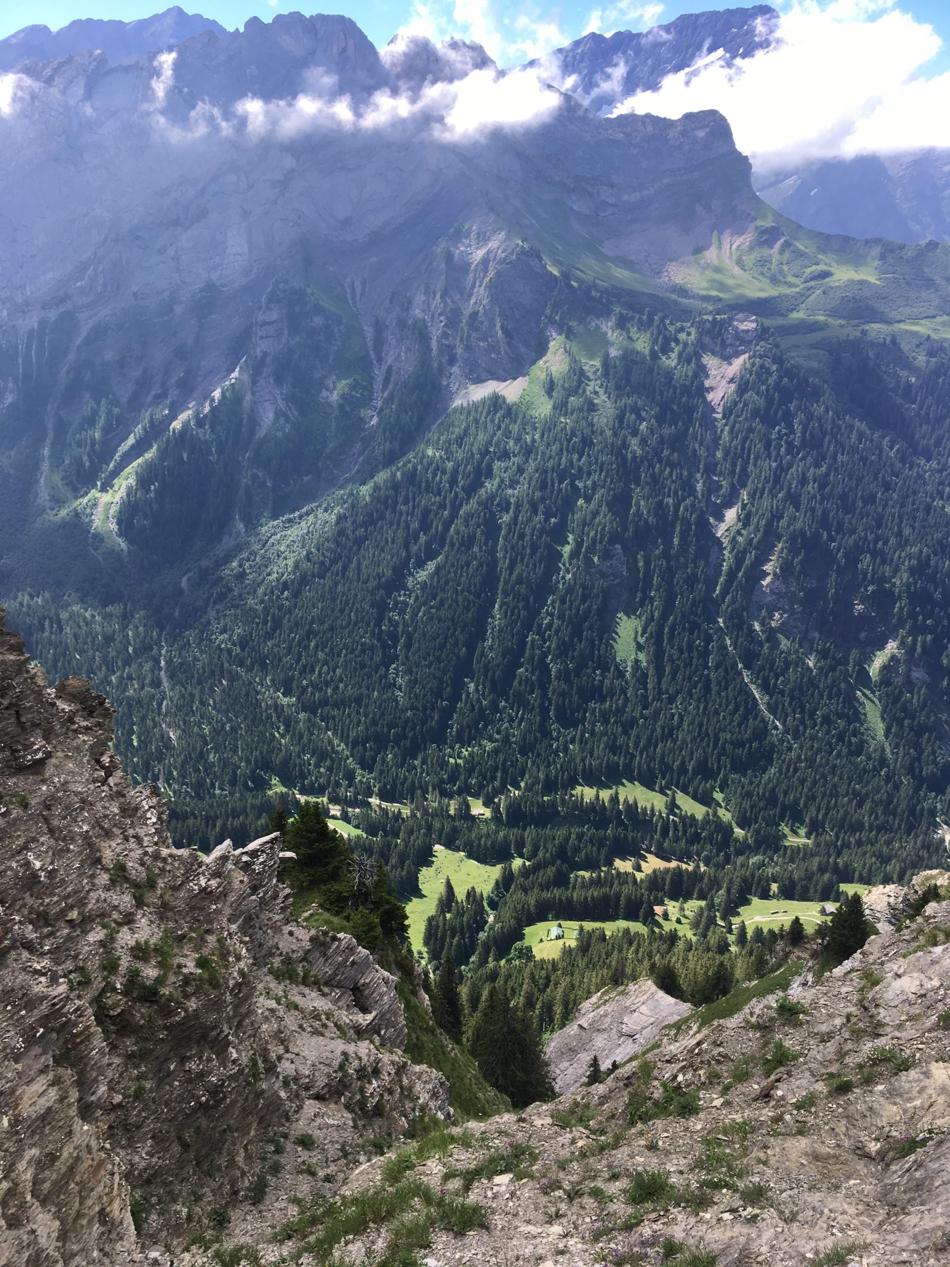
The hike up from Grächen takes you up through a forest. You go through a forest and there is a stream to your left and the nice landscape to your right. The hike up is easy.

As I hike with a water filter I like to get water straight from glaciers when I can. I gathered water from the glacier. It tastes good and it’s fresh. Gathering water from this point is easy.

From this cirque you climb up through some more trees and eventually you get to a nice view point from which you can see the landscape. This provides a good point for a snack and rest.

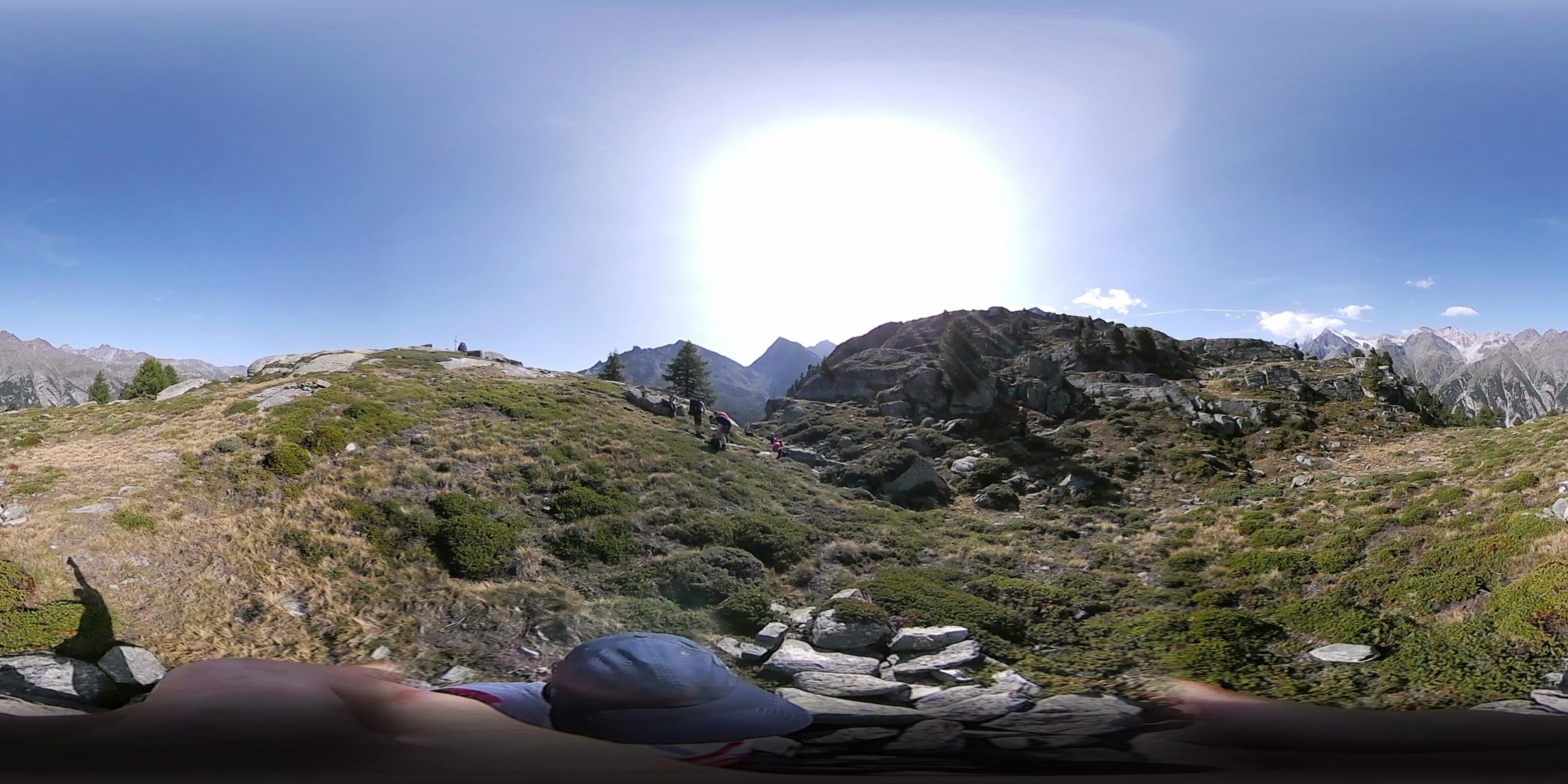
[vrview img=”https://www.main-vision.com/richard/blog/wp-content/uploads/2017/08/export_1503909534859.jpg” width=”500″ height=”500″ ]

Use mouse to look around image above. (360 image)

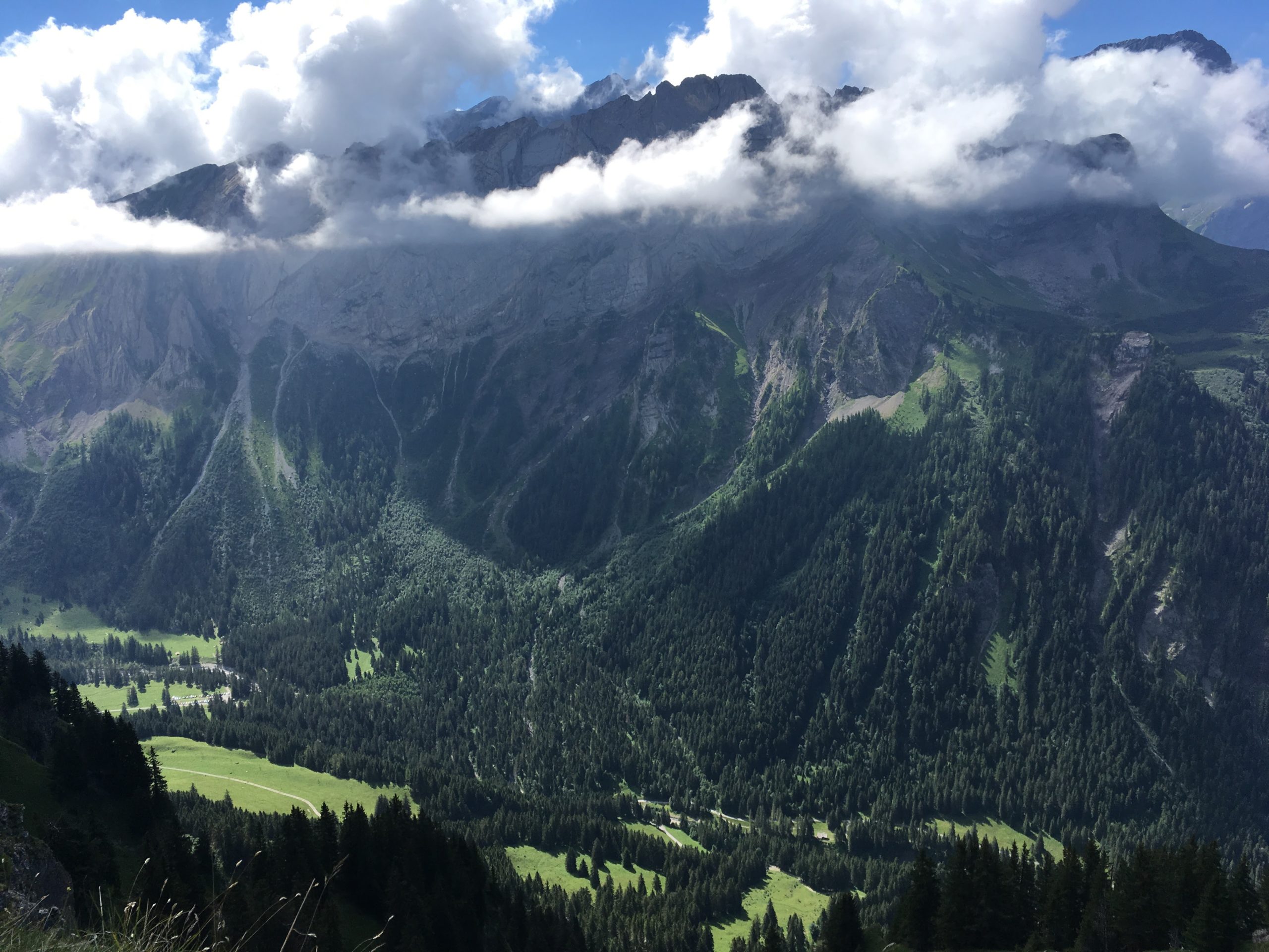
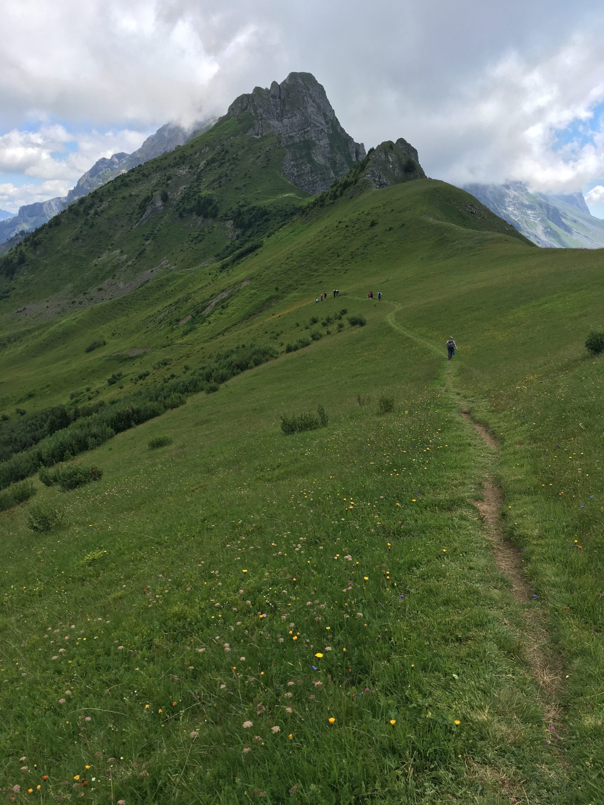
Many years ago the glacier reached down into the valley below. You can clearly see the depth of the former glacier. At this point you are above the tree line. You begin to walk on bare rock. The slopes get steeper and you are more exposed.

One segment of this hike crosses a zone of active rock falls. When we were walking here we heard a loud noise that sounded like thunder or a jet. After a few seconds we saw large rocks falling down the slope and bouncing. Where they hit the ground clouds of dirt and dust erupted. It was too far away for me to get good video footage. At this moment we were more attentive. If you look up you see that massive rocks get loose and fall. Look at the contrast between the sign post and the boulders. You need to scramble and climb over rocks and navigate your way towards safety.

The dangerous zone in context

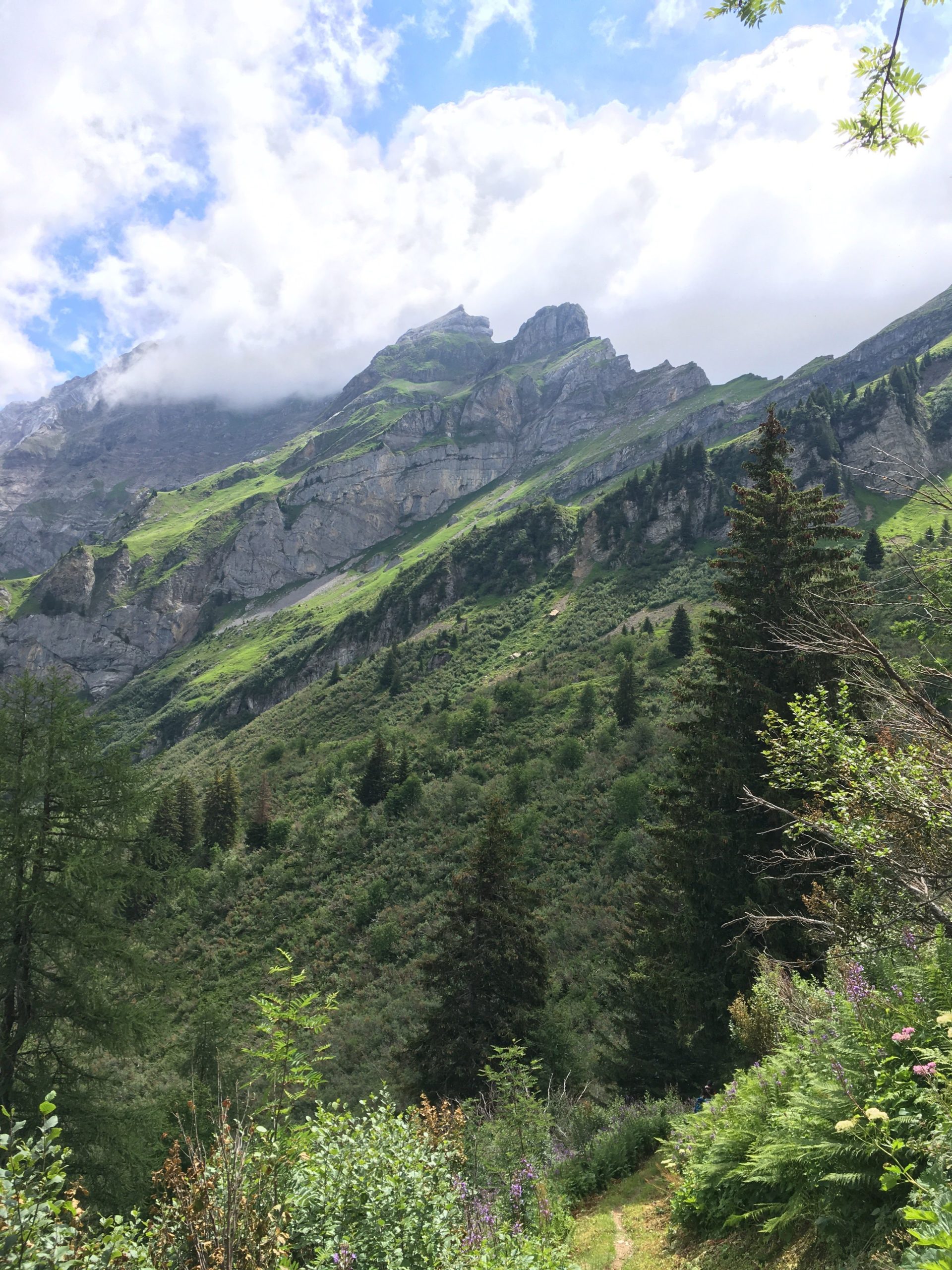
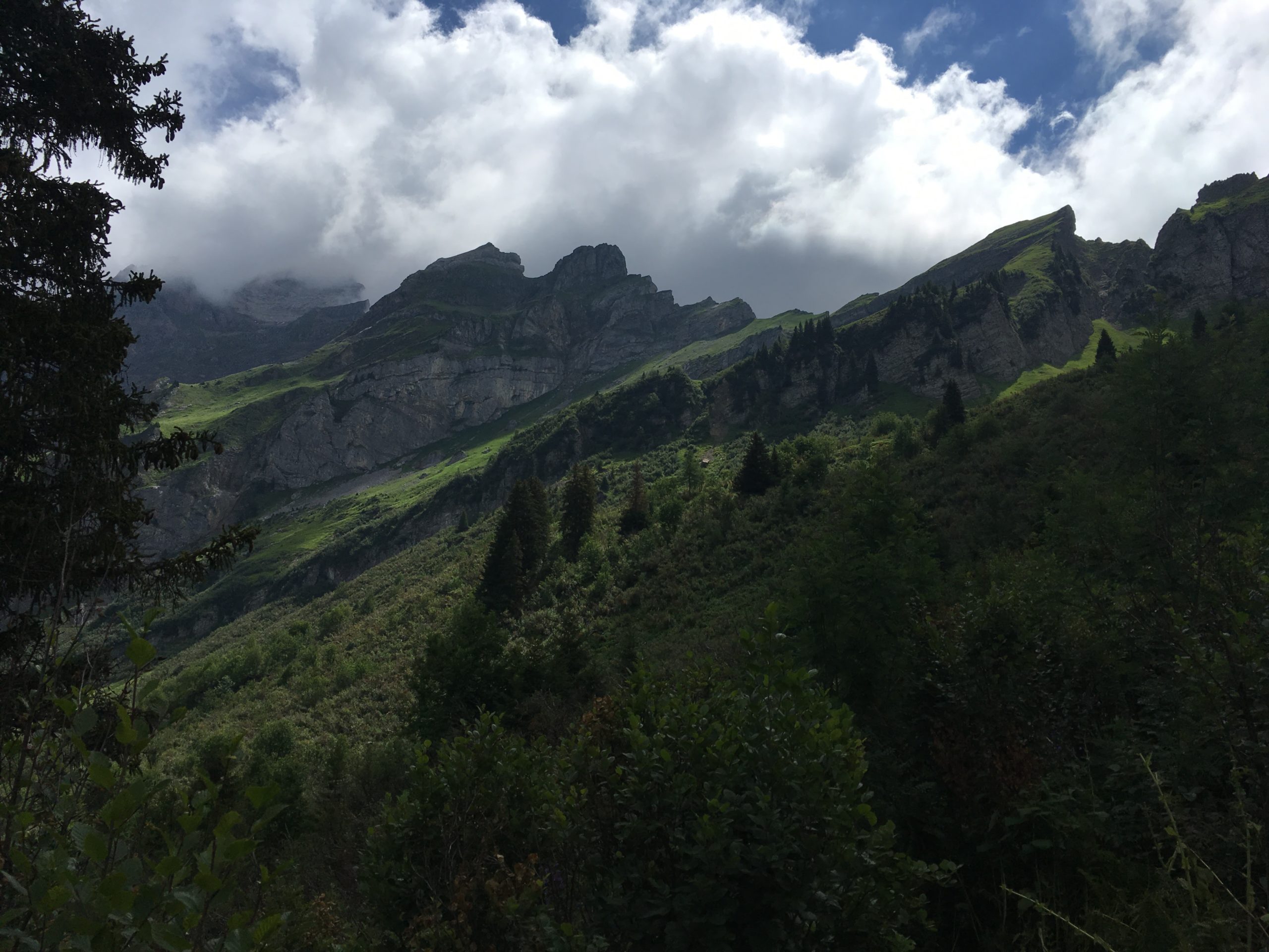
The dangerous zone takes a few minutes to cross and there are big rocks behind which you could try to shelter during a rock fall but the best option is to spend as little time as possible in the dangerous section. Rock falls are usually due to hikers, rain and ice formation. When rock falls are common you see that there is no moss and no trees grow. Later we crossed over boulder fields where trees and moss were growing. The Europahütte is built in an old boulder field overlooking the bridge.

Fractals

In one of the Coastline documentaries I watched a while ago, they said that if you measure the coastline to within one metre you get one distance and if you measure the same coastline to within 30 centimetres or less you would get a much higher figure. During the last few kilometres, this was clearly evident. On the GPS the two or three kilometres were the last two or three kilometres for a long time. The terrain undulates quite a bit and there are many nooks and crannies. In a straight line the distance was 1.6km but in real terms, the distance was closer to three or four kilometres.

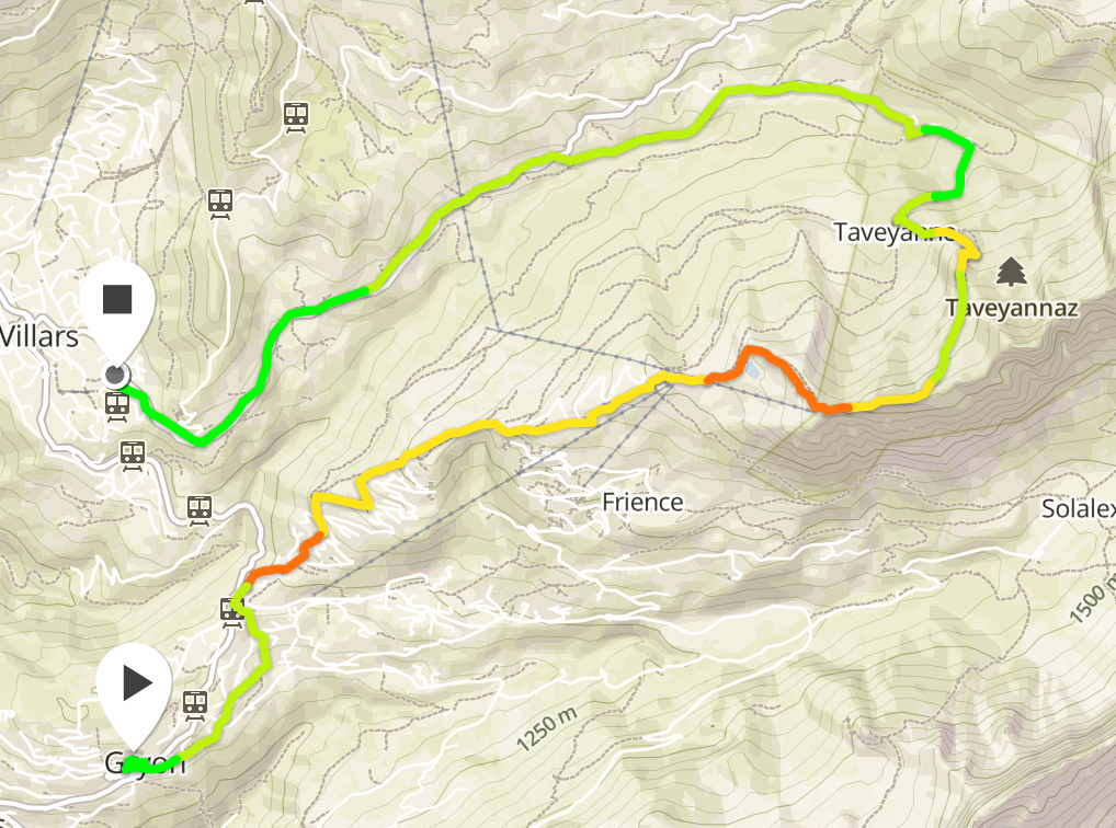
Until this hike, I was used to circular rather than linear hikes. Most of the hikes start in one point and go around to another. When you look at the route track for both days of hiking they go in a relatively straight line.


Caught in a hailstorm 200 meters from the peak
| |

Caught in a hailstorm 200 meters from the peak

A few days ago a group of us were caught in a hailstorm 200 metres from the peak. When we were approaching the summit we aimed to climb clouds came in and covered the peak and rain fell. At this moment we had doubts about going on. Half an hour later the clouds had gone, we could see the summit and so we started for the summit. As we climbed up the conditions were good. There was a strong wind As we got within two-three hundred metres from the top the wind picked up and we could hear lightning several seconds away. At this point, we slowed our climb.

As I looked behind I could see the clouds coming in fast and as I looked the other way I could see the clouds come that way too. By this point the wind was strong and the sky became dark with the clouds we were in. It started to rain and then hail. At first, it was a few very small hailstones but within a minute or two they became large enough to become painful through a cap and a rain jacket hood. We sheltered against rocks to minimise what was exposed to the weather.

The intensity of the hail increased and as I started to feel pain I hitched my hiking bag over my head, shielding as much as I could beneath it. As I did this I looked out and it looked like someone was throwing buckets of hailstones. I could feel my trousers getting drenched and my hands got very cold. The wind shifted and the hailstones started to pummel my back and I stayed sheltered. It was an uncomfortable situation to be in. Water was running from my trousers into my shoes and my feet were soaked.

When the hail started to subside I stood up and we started to head down. I looked up. One person from the group was rushing down and I decided to descend as well for a bit. I couldn’t see the person who was leading the group so I decided to wait. The storm seemed to have passed and I chose to wait. When he came down I blew into my hands vigorously, warming them up again.

Diving in cold lakes I grew used to having cold hands so I did what I always did. I warmed them up again. This was a mild cold. After some dives, I had such cold hands that they hurt so badly that I was close to tears. In this scenario, I was just uncomfortable.

The surface was white with hailstones, as if it had just snowed. The leader did come down, smiling. By this point it was an adventure. The concern we had from being in such a situation became amusement at having experienced extreme weather. It’s the first time that we had been caught in a hail stone after years of hiking in the mountains. I almost always carry my rain equipment when I’m hiking for just such an occurrence but usually, it’s just weight that I carry in case it is required.


Day 1: Hiking from Gryon to Villars Sur Ollon.
|

Day 1: Hiking from Gryon to Villars Sur Ollon.

First evening

This weekend I went on a two day hike. It was a combination of a Summit Foundation themed hike and a Wehike event. The hike was over two days and two nights. We arrived on Gryon on Friday night and stayed at the Chalet Martin. This is a nice relaxed backpacker hostel with a trampoline, bunkbed rooms, optional breakfast and more. It is located within easy walking distance of the train station and is easy to find. I slept well.

First Day

Gryon is an interesting village with some old chalets. Two of these Chalets are hundreds of years old and listed as national monuments. They are side by side with a short description explaining why they are significant. You hike through the village for a short distance before climbing through some woods before getting to a large parking. From the large parking you continue uphill towards Chaux Ronde. You walk along the road for part of the way with some segments where you walk to the side of ski pistes, through some woods and up some pistes. If this was done as a day hike it would be easy to moderate.

For about one to two hundred metres you walk along an Arête which some people might feel uncomfortable doing. You have a steep drop off on either side so being sure footed and self assured are useful.

This is the most exposed parts of the hike. If you want to continue prepare yourself for such moments. If you’re used to the Tour D’Aï or the Rocher de Naye this segment will be pleasant, especially since you can see the Tour D’Aï from here. This is one of my favourite aspects of this two day hikes.


This was one of the most beautiful passages of the hike. You have nice green fields with great potential for numerous flowers. You see Switzerland in all of it’s beauty. The path from this point on is easier going and offers some great views.

When we arrived at this portion of the hike both the clouds and the light were playing with the rock formations so I kept looking right and behind me to see how they had changed, waiting for some interesting lighting to take pictures. If you’re on a photowalk then I would recommend finding a good place to wait for the light to be just right for a nice image. In the wrong light they may look dull.

When the light and mountains play nicely together you get a real separation between the grassy meadows, the cliffs, the sky and more. You get a sense of scale and contour. The rest of the hike down was through trees and then along a road. As I was carrying enough equipment for two days I felt exhausted by the time we arrived in Villars where we had a good meal at a restaurant. Almost everyone had Röesti.

Summit Foundation

The primary focus of this hike was to pick up rubbish left by skiers, snowboarders and other sports enthusiasts over the winter months. We picked up plastic, cigarette butts, gloves and more. Some of us were less passionate about it. If you’re on a hike and you drop rubbish think of the effort that you’re making with a simple hike. By hiking and picking up rubbish the effort is greater. You bend down and get back up frequently. It’s an alternative to burpees.


| |

K2 With a Drone

K2 with a Drone is a documentary following Petr Jan Juracka, a scientific photographer’s trip to K2 with Klara Kolouchova with two drones. He performed extensive testing before setting off on the trip. He flew the drone in a hyperbaric chamber to see how it would react. He flew it in freezing conditions to check that the batteries would cope and then he flew in other places.

He had already flown his drone in a multitude of countries and Pakistan was the latest challenge. We see the journey to base camp. We see images of the snow and ice, of rivers, of challenging roads and more. The documentary mixes fixed camera footage and drone footage in a pleasant to watch manner.

Thanks to God, to a lot of work of professional kindergarten teachers, great support of my parents and a lot of eye-training I see. And I see perfectly! Since the times my vision went good I enjoy every detail, every color and I admire any type of light. – Petr Jan Jura?ka

For some of the cold weather testing:

As I watched this documentary one question I wanted to have answered is how he powers his drone and other devices. Apparently he has a set of solar panels that he can deploy outside his tent. When acclimating at base camp solar panels would be ideal. There is no need to carry a heavy generator and fuel. You just bring a few weatherproof panels, deploy them on the side of the tent and wait for various batteries to charge. In that shot we see that the weather is overcast.

Overall this is an interesting documentary that I would expect to see at events  such as the Alpine Film Festival in Les Diablerets or the Montagne en Scène events. Combined with more footage of the climb of K2 it could provide for a more complete documentary.

Visiting the Creux de Van and spending time with Bouquetins.
| |

Visiting the Creux de Van and spending time with Bouquetins.

Images I saw of the Creux de Van made me want to visit the location in person. Yesterday despite the mediocre weather I went there. From Neuchatel you drive towards Noiraigue. Free parking is available.

For the first hour you are walking up a steep winding path. A few trees have fallen, stones and mud are also present until you reach the top of the cliff. From there you see a glimpse of the cliff and views to come. As I stood there I saw a solitary Bouquetin on the rocks.

From there I went right and walked along the cliff. On one side I had green grass and a farm and on the other side I had a steep cliff. I walked along and came to an outcrop. From here you could see the full cliff face. I walked around the arc until I came across a herd of Bouquetins. They were right in my path. I took several pictures before heading back down the other side. I came across a wooden hut and table where people can have a snack. As you walk through the woods you get towards the end of the Gorge De L’Areuse. It was full of water due to the recent rains. By this point I had already walked 10km so I continued back towards the car.

Another view of the valley

IMG_7243

Woods, Bouquetin and cliff

IMG_7298

The summer eccentricity.

There are four phones on my desk that are well adapted to tracking hikes. There is the nexus one, the e51, n95 and n97. The reason I mention this is battery life. In my experience if you go on a long hike at least one of the phones will die.

You could buy an extra battery or two to make sure that this never happens but a more practical solution is to take all of your phones, install the tracking application on them and swap phone once the battery dies.

Of course this would involve taking three chargers with you but at least this way you could track the hike in terms of chapters and somehow aggregate the data for a true hike map.