Cycling

Cycling to the City that Never Wakes Up

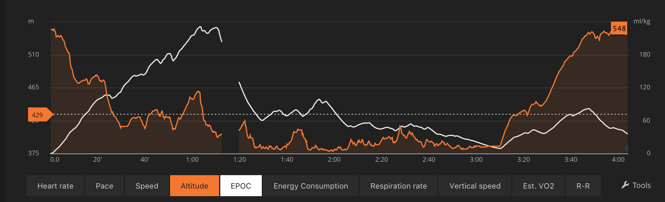
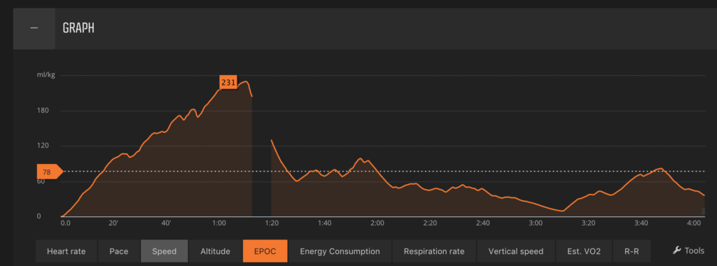
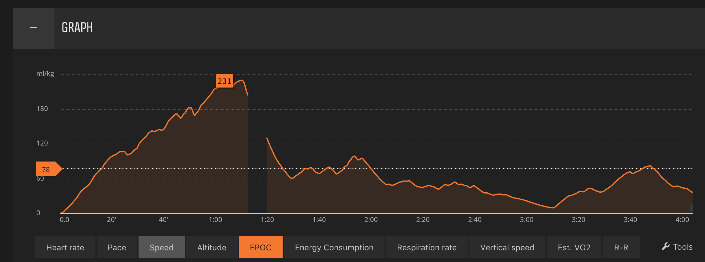
Yesterday I wanted to go for a bike ride. I hesitated between driving to the Vallée De Joux and cycling around the lake, cycling up to Les Rousses and facing a long and sustained uphill or cycling to a meeting in Geneva. In the end, I cycled to the meeting in Geneva. As you see this is a 67 km bike ride with a vertical change 0f 714 metres. On a road bike that’s fine, because the bike is light. On a mountain bike with slick tires and no one to pace me it can be quite tiring. According to the watch, it will take 120 hours to recover from the journey. The segment along Chemin des Pins and Chemin De St Oyend are closed to all traffic except agricultural. This means that you can use the entire road. Rue De La Brunette is a funny name for a street coming off of St Oyend. I enjoy cycling in cities because I see it as a series of sprints, to try to keep up with cars. As they go at just 30 km/h this is easy for a few minutes. I noticed people on e-bikes and I had the intention of drafting behind him but he changed direction so it was short lived. As you can see from the graph above I was making most of the effort on this bike ride as I cycled to Geneva. The gap is where I stopped at Impact Hub to meet one or two people, refill my water bottle and then cycle around Geneva before heading back towards Crans and Nyon. When you live at the foot of the Jura you have two choices for every bike ride. You can head down towards the lake, enjoy your bike ride but then be left with a 200-metre climb or you can cycle up to the mountains and then have a nice downhill on the way home. With training and a lighter bike these graphs could be less extreme. When that becomes the case then commuting to work by bike is feasible.

Environmentalism and Traffic Lights

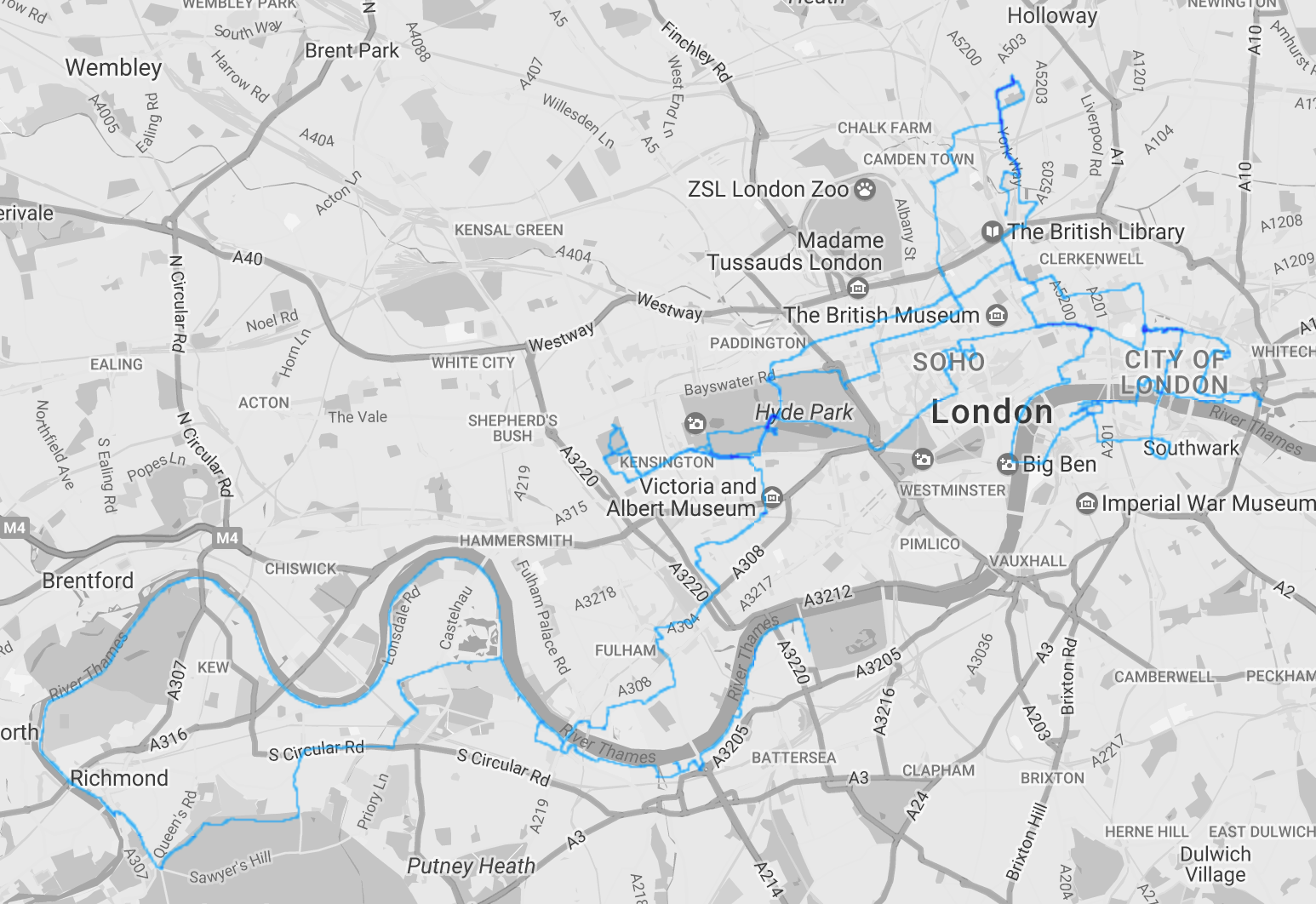
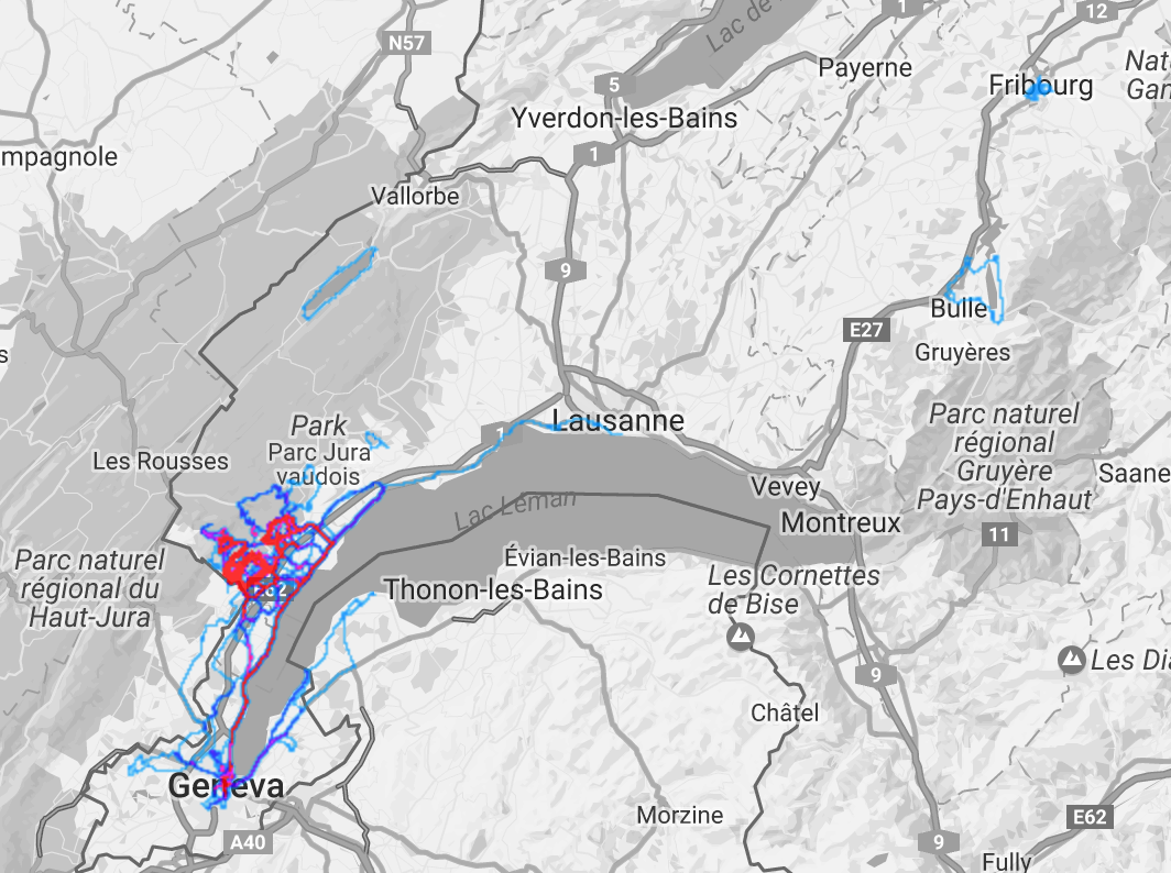
When you’re driving from Nyon to the airport without traffic the journey takes about twenty minutes. If you decide to drive into the city of Geneva that journey time is doubled thanks in main part to traffic lights. It once took me over one hour when scuba diving in Hermance to drive from Place des Nations to the other side of the Mont Blanc Bridge. That’s over one hour for less than two kilometres. That idea cooled down my motivation to dive in Hermance. At the time I was driving a petrol rather than a diesel car. Yesterday I was driving from the foot of the Jura to Cornavin and the drive from the foot of the Jura to Geneva was fast. It’s when you drive from the motorway to the centre that you lose time. 23 minutes to drive 3.8km. I don’t have a start/stop car so when I’m spending 23 minutes at traffic lights the engine is running and polluting the air for nothing. There is no gain from blocking traffic lights. It was even worse when I was on Rue Montbrillant. The GPS indicated 15 minutes to travel about 750 metres. Can you imagine the carbon footprint of traffic lights? That’s 15 minutes of nitrous oxide that had no need to be sent into the air. Imagine the health impact of keeping vehicles trapped at traffic lights. Within 30 seconds I went right and parked at Place des Nations and walked the last 750 metres. I wasn’t going to waste 15 minutes because “environmentalists” decided that the best way to discourage people from driving was for them to sit in traffic and pollute the air. When I was working on Rue Montbrillant I was taking the train to and from Geneva every day and I used an abonnement de route to reduce cost. It works well until you’re reliant on bus schedules. Some routes have one bus an hour. This means that a 30-40 minute drive becomes a one and a half hour public transport route. If you finish your day at 1800 you’d arrive home by around 1930-2000. This means that although you’re taking the environmentally friendly option you’re spending two and a half hours a day to commute. During warmer months and drier days, the scooter was a good alternative. Within minutes you’re on the train to Geneva. That’s the paradox of environmentalism. You want people to be environmentally conscious and you want them to minimise car use but rather than provide them with time efficient solutions to encourage them to take public transport you trap them at traffic lights. Waze, Tomtom and other GPS manufacturers should take the heat maps we generate with our mobile devices every time we drive and design public transport infrastructures to replace the need for cars. This data is already available. Below are two heat maps of cycling around London and Switzerland. If you used the same type of data from cars you could design a system that replaces the need for cars. When you live in a city you see two kilometres as a big distance to drive but when you’re in the countryside 2km is nothing. London on a bike feels tiny after walking and taking public transport. In Geneva it’s not that you have much traffic. It’s that the traffic lights give the illusion of traffic. Most of the side streets are empty of traffic most of the time. [caption id=“attachment_3570” align=“aligncenter” width=“1024”] Distances in London are shrunk by bike. I think it’s the best form of transport, when the weather is favourable.[/caption] This week I wanted to cycle in to Geneva for my lunch time meetings but chose not to because the bike ride is energetic enough without the weight of a 15inch laptop on your back. I did buy a bluetooth keyboard for the mobile phone as a mac book air replacement. That should make cycling more pleasant. I also have spare tires in case I get a puncture. [caption id=“attachment_3571” align=“aligncenter” width=“1024”] Cycling in Switzerland and France[/caption] Geneva’s traffic light policy did work on me. Several years ago I became so tired of waiting at traffic lights when driving into and out of Geneva that I stopped going. Instead of meeting people in Geneva I drove to various lakes to scuba dive and to the mountains to climb, hike, cycle and do other more environmentally friendly activities. This is especially true when we drive other participants. When I climb Fort L’écluse I meet people at CERN and when I meet people to go to Swiss VF I meet them at the Nyon train station, Fourmi metro stations or even the Lavaux motorway stop.

Wordpress and Strava - Using WP Strava on this blog

I installed WP Strava on this blog to share my Strava cycling and running activity. At the time of this blog post you can see my most recent bike rides in the left column as well as the most recent map. With a minimum of code you can also include your bike rides within a post like you see below. You write activity id=number of activity and the ride will be integrated within your blog posts without the need for embed codes and an iframe. [activity id=1026494012] This is useful for activity bloggers such as myself. The code is simple and easy to remember, as soon as I find the right keyboard keys to avoid the need to copy and paste. Shortcodes are to add information to blog posts and the widgets are for the side bar. SHORTCODES activity id=NUMBER – add to any page or post. Also takes the following optional parameters:

The SUUNTO SPARTAN SPORT WRIST HR BLUE

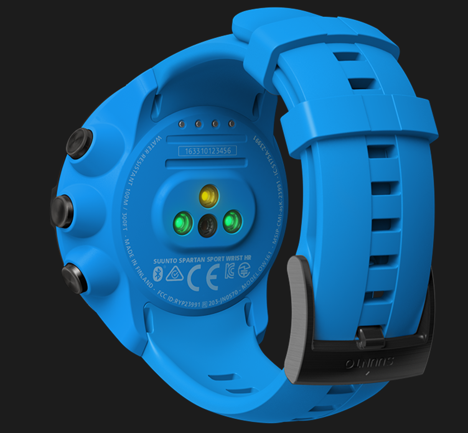
I have logged 799 activities with my Suunto devices. This includes hikes, via ferrata, climbing, swimming and scuba diving. I like Suunto devices because their battery life is good enough to last through entire days of hiking and the battery lasts for weeks between charges when used as a simple watch. Spartan HR I like to track my heart rate but I often feel self conscious about putting the heart rate monitor belt on. With the latest Spartan watch I no longer need to worry about the belt. At the same time as I start the activity I will be able to keep track of the heart rate. This is especially good for group activities when you do not want to keep people waiting and in winter when you’re wearing layers of clothing. I like that devices like the Fitbit Charge 2 can be worn at almost all times and track heart rate effortlessly when at the climbing gym and during other activities. I look forward to the same simplicity with a Suunto device. I especially like that Suunto devices survive swims and showers. I like that the Suunto Ambit 3 tracks how many steps I take during the day. It’s a shame that the step count is not logged and visible on Movescount. I like to see how energetic or lazy I have been on a daily, weekly, monthly and yearly basis. It’s not unusual for me to go from a 21,000 step day to a 6000 step day. It depends on weather, work and other factors. If you go for a bike ride your step count will not be high. I will wait to see whether they apply this technology to the Suunto Ambit watch collection. If they come out with the Suunto Ambit 4 Wrist HR then I will be tempted to upgrade. With 799 tracked activities I believe Suunto devices have demonstrated that they are reliable.

Strava Now Has Rock Climbing, Hiking And More

David - First of May 2018

Hey Richard. I actually built an app to solve this problem. I’m a climber and a runner and I wanted to be able to track my climbing and see all my exercise in one place. You can log your indoor climbs in the app and it lets you enter the grade, how many tops you completed and tailors everything to the specific gym you’re in. There’s no outdoor climbing yet but it’s planned for the future. Check it out on https://www.clamberapp.com if you think it will help you.

Strava Now Has Rock Climbing, Hiking And More

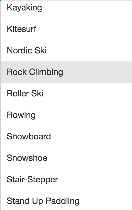
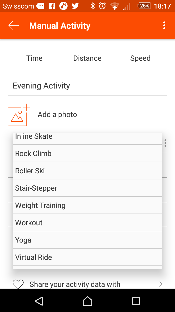
Strava now has rock climbing, hiking and many more sports. Sports tracker, movescount and other applications already allowed you to do this but it is nice to see one more network provide us with this option. [caption id=“attachment_3340” align=“aligncenter” width=“189”]Strava expanded the number of sports you can track Strava expanded the number of sports you can track[/caption] Up until now I had to make sure to go for a bike ride or three per week to keep people updated on what I did. During week days I am likely to go for bike rides. On two to three evenings per week I may go climbing and on the weekend I may go hiking or for a walk. As a result I can track the diversity of my activities. [caption id=“attachment_3341” align=“aligncenter” width=“169”]Strava has updated the list of sports Strava has updated the list of sports[/caption] With rock climbing I would like them to add two or three more fields. I would like them to add an option to add the grade of the climb we did. This would need to use the European and the American systems. It would help us track our progress and even track how hard we worked if we’re wearing a heart monitor as we climb. In effect it could provide us with a way of seeing who else is climbing and whether we match their skill level. In the long run this could contribute to new groups. I have created a group for Swiss Via Ferrata in anticipation of via ferrata practitioners joining the network and sharing their climbs. Until recently I would only track cycling and running. Now that walking, hiking and climbing have been added I can track a number of new sports. It should result in people using the app more frequently.  It could be fun to see climbing and hiking heat maps. We will see how they adapt the input section to match the sports.

Critical Mass in Geneva

For those who like to cycle in a group of people there is a critical mass event organised for the 29th of August from 1830 onwards in Geneva. The meeting point is the île Rousseau. From there they will cycle around the city of Geneva. At the moment of writing this post the weather is meant to be good with sun and 29°c. When I cycled with a group of people in London I had fun. I found that the city of London was much smaller than I had thought. If you don’t know a city it is an opportunity to discover new cycling routes and if you do know the city it is an opportunity to meet new people. The group cycles at a speed that is comfortable for everyone. Those who are confident have time to stop and take pictures or place ingress and Pokemon Go and those who are not as fast are not abandoned. Although not a critical mass bike ride when I met with a group to cycle in Geneva we travelled about 40km. The advantage that I have when I cycle in and around Geneva is that the landscape is flat compared to where I cycle in the countryside. Geneva has bike and bus lanes in the centre and when you get out of the centre you have cycle paths that are separate from road traffic and pedestrian traffic. When youn get to the Geneva countryside the roads are relatively quiet so you do not have to worry about cycling in traffic. There is a critical mass cycling app to make finding the group easier if you meet the group after it has started cycling.

Cycling Trip to Lausanne and Back

When I set off on my cycling trip to Lausanne and back I thought that the strong wind would force me to turn around and that I would abort the attempt by the time I got to Rolle or Morges. As I continued cycling I fought the wind and I made slow progress. When I was in the dips or along certain walls I had a break from the wind. I continued on with the effort. A nice portion of this route is on cycle paths so you are protected from traffic. Sometimes the cycle path is on the side of the road and at other points it is on a pavement at the side of the road. Near St Prex the route bifurcates from the road and goes through a 30km zone. You rejoin the road a few minutes later. Around Ouchy the roads were relatively quiet. [caption id=“attachment_3136” align=“aligncenter” width=“660”]I stopped in Ouchy to recover I stopped in Ouchy to recover before cycling back.[/caption] The air temperature when I set off was about 20°c with wind. As I cycled I never felt too warm. It was a great temperature in which to cycle over a long distance. For the first hour I was drinking Jura water before switching to electrolytes for the route back. I usually carry enough water or snacks for part of the journey and when I feel the need for a rest I stop and pick up more supplies. It keeps the weight down. I was lucky when I cycled back towards Gland because the wind continued blowing in the same direction. The wind that I had spent the outward journey fighting was now in my back. As a result despite muscle fatigue the cycle back was comfortable enough and I still managed to get a good time. The challenge when cycling from the foot of the Jura is that you eventually need to spend energy to get from the lake uphill. It might be psychological but the place from which I like to climb from the lakeside is through Gland. There are a number of routes with reduced traffic or you can take the main road. In this case I took the main road and when I was passing the train station I felt the rear wheel wobble so I stopped to check the wheel but it seemed fine. I then cycled a little further and then heard the rear tire flopping. A thorn had made its way in to the tire and punctured it. I had noticed that there was a cycle shop on the lake road so instead of going to the two sports shop near the bouldering gym I went to this one. The owner was just about to leave when he saw me pushing my bike. He was very helpful. He helped me replace the tire and pump it up again so that I could continue my journey. I had always worried about getting a puncture and I was lucky that it happened in such a convenient place. I had to walk back about two kilometres but in the end the inconvenience of the puncture was quickly resolved and I could head home. It provided me with time to recover before heading up the hill once again. I am amused that it was a thorn. I cycle around rocks, glass and other hazards on the road and nature got me with a simple thorn. To be fair I had cycled about nine hundred kilometres before getting a puncture. [caption id=“attachment_3137” align=“aligncenter” width=“225”]Some of the landscape you see Some of the landscape you see[/caption]   In the back of my mind I was always ready to cycle to Lausanne and then catch the train back but my endurance lasted both ways so I skipped the train. My next challenge will be to cycle around the Lac de Neuchâtel which is meant to be about 96 kilometres depending on the route you choose.

Half Way Through To This Year's Cycling Goal.

So far this year I have been cycling for 680 km in 33hrs with a height gain of 6800 meters. In this time I have used my narrative clip 2 device to document the ride with a picture every 10-30 seconds as I want to focus on riding rather than other things. I like to have as high a moving time as possible so I usually stop once I get back to my starting point. By cycling I see the landscape at a slower, more interesting speed. I see the roads, I smell the vegetation, I feel the heat and I feel the cold. I also discover small paths that I would not take in a car or on a scooter. In practicing this sport I get to know the landscape. I also get to see seasonal changes. This year I have cycled in the rain, in the snow, in the wind and on days like today. Today it was sunny and there was no wind to fight against. It made the ride more pleasant. The technology I took on today’s ride was my narrative clip 2 to take pictures of the bike ride, my Crosscall Odyssey+ phone, the Cateye Evo+ and finally the Suunto Ambit 3. I also took the Ricoh Theta S but never stopped to take pictures. For future rides I should fix it to the handle bars. I could bring you with me on my next bike ride. Of course I would keep just the interesting bits of the ride. I can throw away the rest.

Vittorio Brumotti in Livigno

For years I have enjoyed watching the Tour De France and often call it the French Landscape program. In this case we start with Vittorio Brumotti cycling with his team before becoming distracted and going to enjoy some mountain bike trails, some balancing on barriers, floating in a swimming pool, enjoying a running carpet and more. It shows the area of Livigno and what it has to offer in summer. You might remember him for a video from earlier this year or last year. I like that road cycling teams have athletes who can show their balancing and other skills. It makes the sport more entertaining to watch. Remember when he cycled in the plane graveyard and on that barrier?