Yesterday my intention was to cycle along the Voie Verte from Crassier to Grilly and then back down towards, the lake, along the lake and end up back in Nyon. I didn’t follow this plan through. I was thinking “I don’t want to do the steep Mies climb so I’ll go to Nyon, but on the way to Nyon I thought of going to Prangins. In Prangins I then decided to head to Aubonne. In the end I did ride to Aubonne.
Today I cycled for three hours. I cycled to the Rhone and back along cycling lanes. Initially I had planned on a little 20km loop but because of dog walkers walking with their dogs, off of leash, I decided to ride along the road for a bit, before joining the voie verde again at the lac De Divonne.
Yesterday I set off for a bike ride planning to go from Nyon to Gland, and then up and around before heading back to Geneva and then from around Versoix riding back to Nyon.
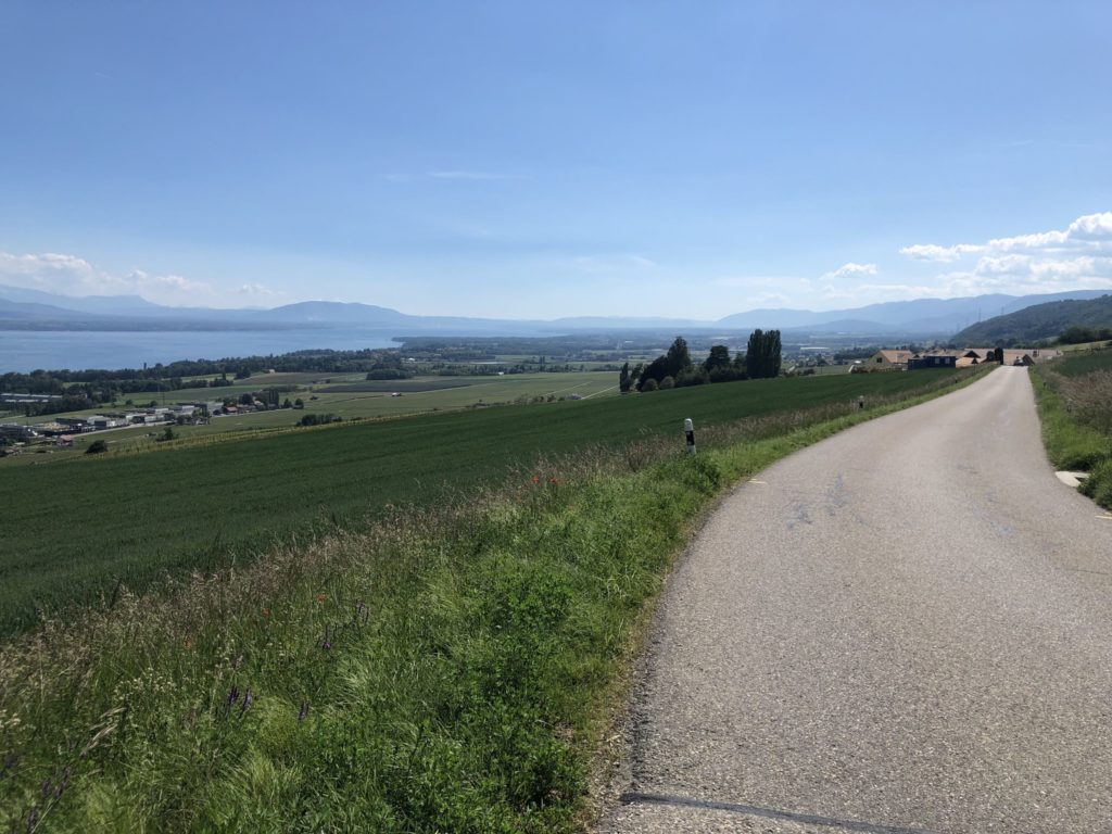
Instead of this I rode from Nyon to Gland and decided to go further and once at Gland I rode a little further and I ended up in Rolle. In Rolle I continued going thinking I’ll turn off and head to the top of Aubonne and ride to Geneva. Instead I went up to the Signal de Bougy and from there enjoyed the ride back down towards the foot of the Jura. I continued this way and when I got twards Trelex I ran out of water.
I thought about stopping at the petrol station but didn’t think “If I continue to La Rippe and Divonne I can find a water fountain. Eventually, I did, in Crassier. I took on a little water and cycled on the cycling/walking path to Divonne, went around part of the lake and then headed back to Switzerland. Once in Switzerland I turned right and headed for Versoix via the top route. I went down the road that passes by the observatory and then at the roundabout near the swimming pool I turned left and when I got to the intersection where I had to choose between Mies and the petrol station or going left I decided to go left.
By this point of the ride I was running out of energy to pedal. I stopped for a minute or two and then set off again. I was running really low on energy and I had just enough strength to keep moving forward. When I was crossing Borex towards Signy I was feeling so tired that even my arms were fatigued. I really felt low in energy. I finally made it to the station, got an electrolyte drink, some chocolate and headed home.
When I got home I collapsed on the couch but that wasn’t enough so I lied on the floor for a few minutes, just to rest a bit. It’s rare for me to exhaust myself like this. I did do two of my regular rides in a single ride.
I did cycle up from the lake side to the Signal de Bougy. I did race one postal bus down a hill and try to go faster than a TPN bus as it crossed the border. In theory I should have stopped around Trelex when I ran out of water but didn’t.
According to the Suunto watch it will take me 89 hours to recover. I’d call that a success. I went from wanting to do a fourty kilometre loop to doing an 80 kilometre loop, with a nice climb thrown in.
I was probably tired because I did this 80km ride on two pieces of money cake, without a proper lunch. 😉 This circuit took me about three and a half hours with no stopping for the first hour and a half or even beyond. With two or three snacks I would probably do this ride without suffering so much.
The Via Ferrata Jacques Revaclier is located on the Salève a short drive from Vitam Parc and within easy driving distance of Geneva and Nyon. The Via Ferrata requires scrambling over a few metres of rock to get to the start.
This via Ferrata has two parkings. The first of these is for the Abbaye de Pomier and the second is for the “promeneurs”. If the abbaye parking is empty use this one because you may hit the bottom of your car on the dirt track heaving up to the hiking parking.
The hiker parking
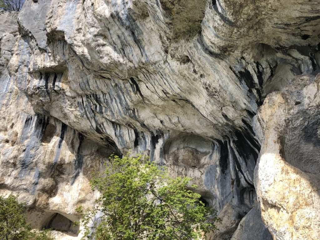
This via ferrata goes sideways rather than up and requires you to go down and then up, and then across. You walk under the rock formation pictured below and then get to a section where you are more exposed to seeing the landscape and the landscape below. If you’re used to via ferrata then this is the moment you will enjoy and if you are new to via ferrata then this is the moment that will either convince you of your love for the sport, or to try something tamer next.
Nice rock
When you get to the end of the via ferrata you will come into a cluster of trees and you are meant to follow the red paint back to the path down. This is not well marked so requires some tracking skills. I created a GPS track of this trip. Keep in mind that later in the season the track should be clearer. At the start of the season teams of volunteers have usually not cleared these paths.
Beginners can try this via ferrata but be aware that the last part may be a challenge for beginners so prepare them for the last section. It’s short and easy to surmount but be wary of it.
To provide the best experiences, we use technologies like cookies to store and/or access device information. Consenting to these technologies will allow us to process data such as browsing behaviour or unique IDs on this site. Not consenting or withdrawing consent, may adversely affect certain features and functions.
Functional
Always active
The technical storage or access is strictly necessary for the legitimate purpose of enabling the use of a specific service explicitly requested by the subscriber or user, or for the sole purpose of carrying out the transmission of a communication over an electronic communications network.
Preferences
The technical storage or access is necessary for the legitimate purpose of storing preferences that are not requested by the subscriber or user.
Statistics
The technical storage or access that is used exclusively for statistical purposes.The technical storage or access that is used exclusively for anonymous statistical purposes. Without a subpoena, voluntary compliance on the part of your Internet Service Provider, or additional records from a third party, information stored or retrieved for this purpose alone cannot usually be used to identify you.
Marketing
The technical storage or access is required to create user profiles to send advertising, or to track the user on a website or across several websites for similar marketing purposes.